


Like many disciplines today, science is rapidly moving toward global solutions — and climate science is no exception. Among the biggest questions driving this progress stand: What is the current state of our natural ecosystems? And how confident are we about our assessments? Understanding this is absolutely critical if we want to tackle climate change effectively.
Since the launch of the first long-term optical satellite missions in the 1970s, remote sensing has continuously transformed environmental monitoring, enabling us to assess the condition and resources of forests and other natural landscapes with unprecedented scale and precision. Most recently, incredible advances in remote sensing technology, big data, and computer & machine learning science have provided access to a treasure trove of global data covering Earth’s ecosystems like never before. This has introduced a new framework of possibilities, enabling the development of large-scale models that previously exceeded available computational capabilities.
For those of us working in environmental science, these large-scale models have become key resources. In recent years, numerous data products (e.g., satellite-derived datasets, models, and geospatial tools) have been developed to reliably estimate regional or global carbon stocks, offering insights without the need for extensive field measurements.; A game changer for large-scale projects and historical assessments. Many organizations and institutions use these tools regularly to report on how ecosystems are changing in response to climate change, giving us vital insights into the health of our planet’s ecosystems. That said, there’s always a trade-off.
Large-scale global models tend to sacrifice some accuracy in exchange for broad coverage and scalability. This means they are a suitable option for big-picture assessments, but they tend to fall short as a reliable substitute for detailed, localized fieldwork data, which remains essential for achieving accurate and site-specific information.
And that’s where fieldwork still shines. When it comes to forest carbon assessments, fieldwork campaigns stands as a crucial step for understanding the complexities of forests. Getting out on the ground experiencing the harsh conditions, battling weather, observing and monitoring trees, soil, and wildlife firsthand remains essential for understanding the intricate relationships within ecosystems. This hands-on experience not only allows for direct observation of ecological processes, but also serves as the indispensable bridge that connects theoretical knowledge with real-world understanding.

(Helicopter pick-up after a day of fieldwork at the Kuamut Rainforest Conservation Project)
In our projects, fieldwork is essential, as it helps bridge this gap by training and calibrating large-scale models with high-quality local data. This kind of detailed, site-specific information significantly enhances the accuracy and reliability of carbon estimates. Likewise, field data collection allows us to validate findings obtained from remote sensing imagery, further increasing confidence in continuous monitoring work. This task relies heavily on the dedication and hard work of our field teams, who often operate in remote, challenging environments to gather the high-quality data these our carbon and biodiversity models depend on. Yes, it takes time, effort, and careful planning, but it is absolutely necessary if we want to meet the highest scientific standards and uphold our climate commitments.
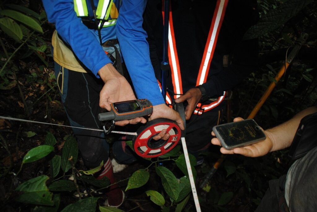
(Members of the Kuamut Project field team from SEARRP using the bearing method to locate a specific tree within a vegetation plot)
But it is not all just about measurements. Fieldwork also offers the opportunity to connect with local communities who have lived in and with these forests for generations. There is a strong intangible value in spending time in the forest which allows us to learn about another wide range of ecosystem aspects such as how the seasons affect forest processes, or how the ecosystem supports the lives of those living in or near it. This invaluable exchange of knowledge not only enriches scientific understanding but also helps ensure that conservation efforts and associated work respect and support the people who depend on these ecosystems.
Engaging with local communities also helps build trust and fosters collaboration, which is crucial for the success of long-term environmental projects. After all, protecting forests isn’t just about trees, carbon, and climate; it is also about transforming the way we “people, cultures, and livelihoods” intertwine with them.
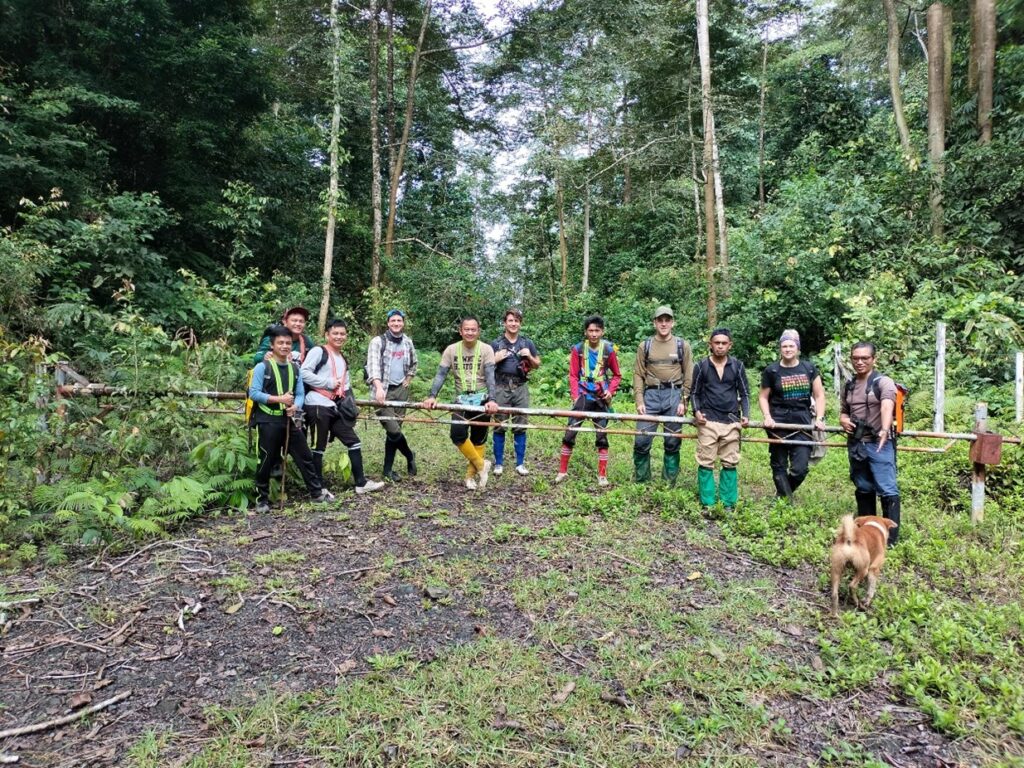
(Kuamut project field and technical teams, and ‘Milo-Dog’ ready for a Vegetation plot survey)
In short, present and future of ecosystem science lies in adapting to new technologies, combining cutting-edge technology with boots-on-the-ground observation and meaningful local partnerships. Together, they help us track, understand, and protect our planet in ways we never thought possible.
Katingan Mentaya website HERE
Kuamut Rainforest Conservation Project page HERE
For more news HERE